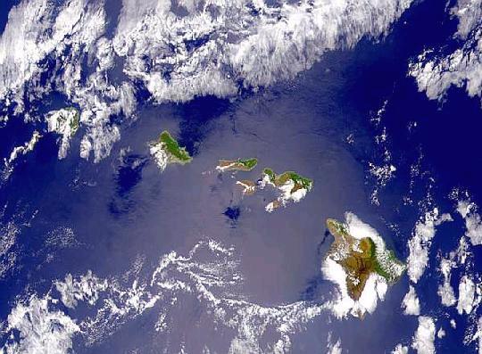
 Here is a map of the major islands of the Galápagos: :
Memorize the English and Spanish names of the major islands and be ready to identify them on a map by tomorrow. Just do it. Don't be a baby.
| Spanish name | English name |
| Española | Hood |
| Fernandina | Narborough |
| Genovesa | Tower |
| Isabela | Albemarle |
| Marchena | Bindloe |
| Pinta | Abingdon |
| Rábida | Jervis |
| San Cristóbal | Chatham |
| Santa Cruz | Indefatigable |
| Santa Fe | Barrington |
| Santa Maria or Floreana | Charles |
| Santiago | James |
Typically, visitors use the Spanish name. In cases where this is not the practice, we have boldfaced the usual name.
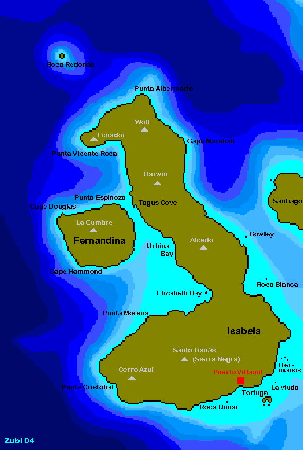 Most volcanically active islands have only one volcano however Isabela has six. Be prepared to identify them on a map.
That's nice. How did the islands get there? To answer this, we must indulge in a brief geological diversion.
Rocks:
What is a rock? A purely descriptive definition is that a rock is - A naturally occurring aggregate of minerals and other solid material. - Usually, there are several minerals in the aggregate, though some rocks may have only one. The other materials may include natural glasses, organic material, or fossils.
Geologists usually think of rocks in a second important way, however. Please and recite it like a mantra:
A rock is a record of the environment in which it formed.
Rock types:
Today we recognize three basic types:
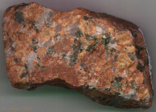
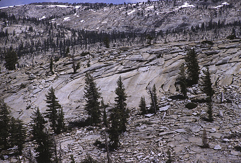 Plutonic: (also "intrusive") Igneous rocks that formed underground from slowly cooling magma. These have large visible crystals. E.g.: Granite (hand sample). (Right: Granite outcrop at Yosemite.)
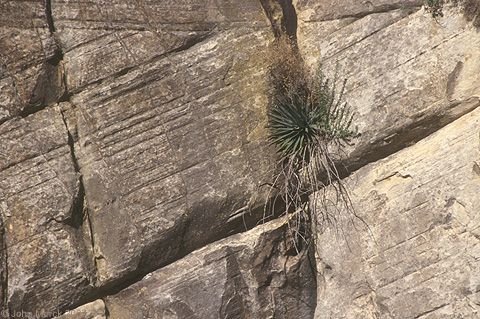
 Volcanic (also "extrusive"): Igneous rocks that formed near the surface from rapidly cooling magma. These have small, sometimes even microscopic, crystals. E.g.: Basalt (hand sample).(Right: Basalt flow on Santiago.)
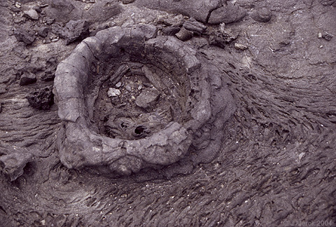
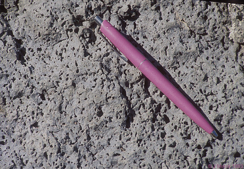
 Chemical: Rocks precipitated directly from ions in solution (halite (rock salt) hand sample).
(Right: Playa (dry lake bed) in Nevada.)
Chemical: Rocks precipitated directly from ions in solution (halite (rock salt) hand sample).
(Right: Playa (dry lake bed) in Nevada.)
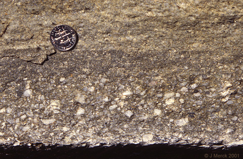
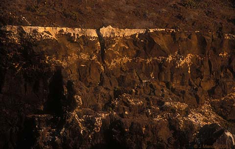 Biogenic: Rocks made of the remains of organisms (Reef-rock limestone). (Right: Limestone exposed in Baltra cliffs.)
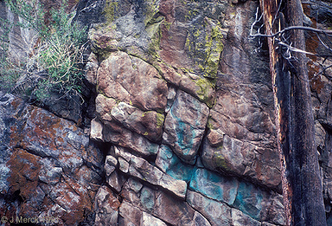
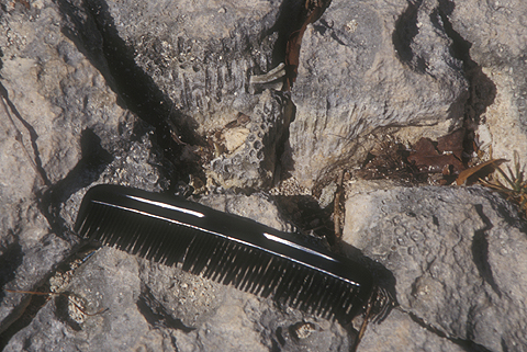
 Clastic: Rocks made of fragments remains of preexisting rocks (conglomerate - sandstone at Sideling Hill, MD). Right: Coconino sandstone in Grand Canyon, AZ.)
- Igneous - solidified from molten material
- Metamorphic - recrystallized by heat and/or pressure.
- Sedimentary - composed of remains of preexisting rocks.

The material that makes up any rock might have a complex history.
- The grains of quartz sand in a sandstone might have been wethered from a quartz vein in a metamorphic rock that prior to being metamorphosed, had been an igneous granite.
- That same sandstone may, in the future, become buried deep in the crust, undergo metamorphism, melt, and resolidify as an igneous rock.
Geologists describe this range of possible histories as the Rock Cycle. As the schematic shows, it actually encompasses many possible cycles.
Plate Tectonics
In Darwin's time, people expected that the topography and composition of the ocean's floor should resemble that on land. The first practical test of that hypothesis occurred in 1872 when the British government sponsored the first interdisciplinary research expidition to expore the world's oceans - the four-year voyage of the H. M. S. Challenger. The deep oceans defied expecataions:
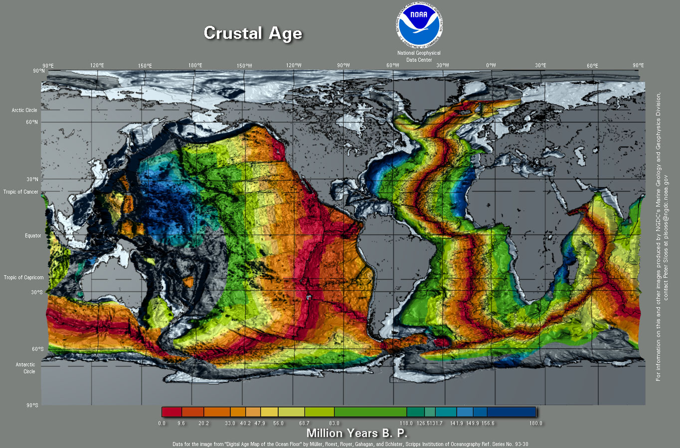
- The rocks were very young compared to those on continents. None older than the Cretaceous (i.e. <=145 million years, whereas continental rocks can range up to 3.8 (or maybe 4.2) Ga.)

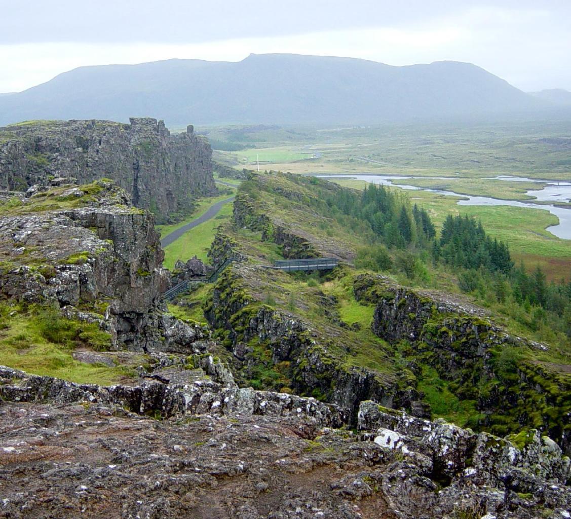
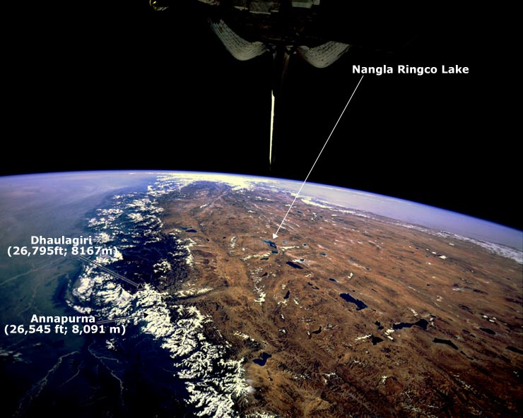
- Bizzare mid-oceanic ridges ran down the middle of oceans. These were soon recognized to be the longest mountain ranges in the world. They are typically highly symmetrical around a ridge axis and at their crests are long rift valleys. (We can see this directly at the Thingvellir in Iceland where it extends above sea level.

- Deep trenches fringe the margins of most oceans. These are parallelled by chains of active volcanoes.
Answering that question took about eighty years. Many people contributed to the answer, but two major figures were:
- Alfred Wegener (1880-1930) A German geophysicist and meteorologist who performed field work in Greenland, where, he had ample opportunity to observe the behavior of glaciers. Ice, when greatly compressed, flowed plasticly, allowing the ice sheet to glide slowly across the underlying rock. Did the light rocks of the continents slide across the heavy ocean floor in the same way? He noticed patterns of :
- Matching shorelines across oceans.
- Mountain belts are linear and tend to occur on one side of continents.
- Matching rock types and fossils across oceans.
- Continents separated by oceans tended to have matching records of continental glaciers.

- Matching shorelines across oceans.
- Harry Hess was an igneous rock geologist (a "hard-rock" man) who had participated in surveys of sea floor magnetism in the 1950s and early 60s. These had shown:
- Bands of rocks whose intrinsic magnetic fields had normal magnetic polarity alternated with parallel bands showing reversed polarity. These bands paralleled the mid-ocean ridges. Thus, bands of rock with the same polarity must be of roughly of equal age.
- Furthermore, these bands formed pairs of mirror image counterparts on the opposite side of the ridge. It appeared that sea floor was forming and at the ridge crests and moving apart, as if they were being spooled out.


Layers of the upper Earth:
- Lithosphere: The zone in which rocks are rigid and deform brittlely. Includes the crust and upper mantle. The lithosphere is broken into distinct rigid plates.
- Asthenosphere: A region of the upper mantle beneath the lithosphere in which rock is partially molten and deforms very ductilely. Plate movement occurs when lithospheric plates glide over the ductile asthenosphere.
- Below this the mantle rock deforms ductilely but contains less liquid and is therefore more stiff than in the asthenosphere.
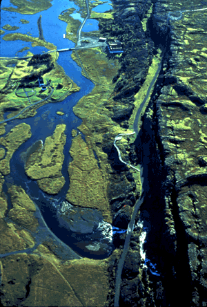
- Divergent boundaries: New oceanic crust is formed by frequent volcanic eruptions along the length of mid-ocean ridges and is pushed outward from them gradually. (We usually can't see this directly because they are under water, however a divergent boundary is exposed above water at the Thingvellir in Iceland.

- Convergent boundaries: Old oceanic crust is destroyed when it subducts or dives beneath adjacent plates at subduction zones. Oceanic trenches are the topographic expression of these subduction zones.
- Oceanic crust behaves differently from continental crust, being denser. Whereas sea floor gets subducted, continental rock is light enough not to, although it can be profoundly deformed, when two continents (i.e. blobs of continental crust) collide above a subduction zone.
- Mid-ocean ridges and subduction zones largely divide the oceanic crust and uppermost mantle into rigid plates that glide across a deeper layer of ductile and partially melted rock and move relative to one another.
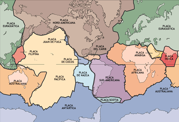
- North American
- South American
- Caribbean
- Pacific
- Cocos
- Nazca
Thickness: The thickness of the lithosphere varies depending on:
- whether it carries oceanic or continental crust: Continental lithosphere is, on average, 150 km thick, although it can be thicker beneath mountain ranges.
- how far from a mid-oceanic ridge it is. Old oceanic lithosphere is up to 100 km thick, while at the axis of a mid-oceanic ridge, it may be only ten km thick.
Plate tectonics' explanatory power:
- Distribution of earthquakes and volcanoes along plate margins.
- Locations of orogenies - mountain building events. There are two types:
- Peripheral, result of the leading edge of continent interacting with a subducting oceanic plate. E.g. Andes or Cascades.
- Interior, result of collisions of and coalescence of continents. E.g. Himalayas (an ongoing orogeny). The Appalachians, Atlas, Urals, and others represent ancient interior orogenies.

- Apparant motion of hot spots:
There are places where volcanoes erupt not in a plate-boundary subduction-zone volcanic arc, but at a single point. Examples are
- In the middle of an oceanic plate: Hawaii,
- In the middle of an continental plate: The Yellowstone Basin.
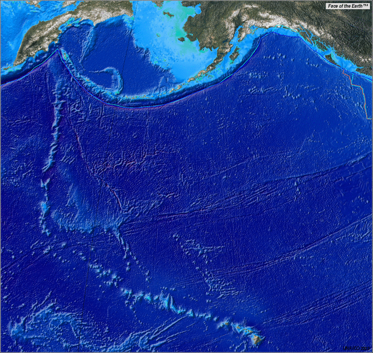
These are called hot spots. The sources of their heat are rising plumes of hot mantle rock that originate far below the domain of plate tectonics - maybe in some cases from the mantle-core interface. Whatever their origin, they are rooted deep in the Earth. Nevertheless, they often sit at the end of lone strings of extinct volcanoes. Hawaii contains the youngest volcanoes in the Emperor Seamount chain. These chains form as a plate moves over the hot spot, continually carrying away the older volcanoes and allowing new ones to form. Similar to the effect of allowing an old vinal LP to rotate over a bunsen burner flame.
- Occasionally a mid-oceanic ridge and a hot spot directly coincide. In this case, you get a great surge of volcanic activity from both sources, as in Iceland.
 The Galapagos Islands are the visible manifestation of an oceanic hot spot, however, being near the spreading center between the Cocos and Nazca plates (which has, itself, drifted to the north over the hot spot relatively recently) their history is somewhat like that of Iceland. The Galapagos hot spot is responsible for both the Cocos and Carnegie Ridges.

