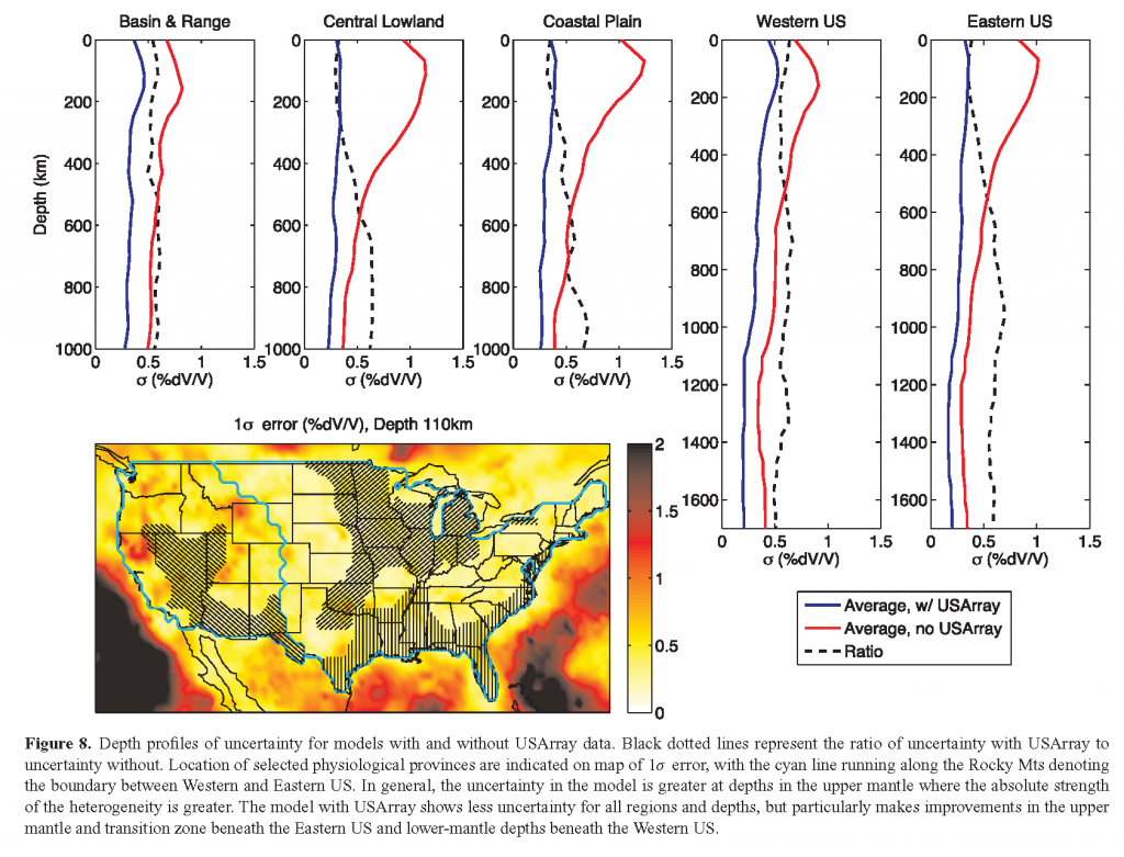
The EarthScope project has been described as the Apollo program of the solid Earth community. It has enabled an unprecedented investment in seismic instrumentation, and the creation of a uniform and high-quality network covering the United States. Data collected by this network transformed our ability to image the continent and what lies beneath it. In a paper published recently in Geophysical Journal International, Prof. Scott Burdick and Prof. Lekic systematically quantified exactly how much EarthScope data contributed to the reduction of uncertainty in P-wave tomography beneath North America. They found that overall, the average uncertainty (1σ) of compressional wave velocity estimates beneath North America is ∼0.25% ΔVp/Vp, increasing with proximity to complex structure and decreasing with depth. By comparing models obtained with and without EarthScope data, they quantified that this data reduces the uncertainty beneath the Eastern US by over 50% in the upper mantle and 25–40% below the transition zone and ∼30% throughout the mantle beneath the Western US. This can be understood in terms of the ray geometries of events recorded at the new, EarthScope-related stations. Teleseismic P-waves arriving in the Eastern US from earthquakes around the Pacific pass beneath the Western US through the lower mantle, so the addition of stations in the east is beneficial at those depths. Meanwhile, those stations add few additional ray paths in the lower mantle beneath the Eastern US, and the ray paths contributed by new stations in the west make a relatively small difference compared with existing coverage.
